


PRAIRIE Voting District, Marion County, Arkansas
About
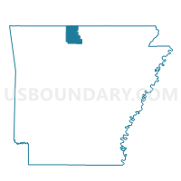
Outline

Summary
| Unique Area Identifier | 527275 |
| Name | PRAIRIE Voting District |
| County | Marion County |
| State | Arkansas |
| Area (square miles) | 28.67 |
| Land Area (square miles) | 28.67 |
| Water Area (square miles) | 0.00 |
| % of Land Area | 99.99 |
| % of Water Area | 0.01 |
| Latitude of the Internal Point | 36.17106660 |
| Longtitude of the Internal Point | -92.83358090 |
Maps


Graphs
Select a template below for downloading or customizing gragh for PRAIRIE Voting District, Marion County, Arkansas


Neighbors
Neighoring Voting District (by Name) Neighboring Voting District on the Map
- BIG SPRINGS Voting District, Marion County, AR
- Blythe Voting District, Boone County, AR
- BLYTHE Voting District, Marion County, AR
- HAMPTON Voting District, Marion County, AR
- INDEPENDENCE Voting District, Marion County, AR
- Prairie Voting District, Boone County, AR
- SOUTH JOE BURLESON Voting District, Marion County, AR
Top 10 Neighboring County Subdivision (by Population) Neighboring County Subdivision on the Map
- Marion County township, Marion County, AR (16,653)
- Prairie township, Boone County, AR (444)
- Blythe township, Boone County, AR (245)
Top 10 Neighboring Unified School District (by Population) Neighboring Unified School District on the Map
- Harrison School District, AR (21,103)
- Yellville-Summit School District, AR (6,259)
- Ozark Mountain School District, AR (5,101)
- Valley Springs School District, AR (4,243)